

(Editor’s note: This piece is adapted from my 2021 report on redistricting commissions)
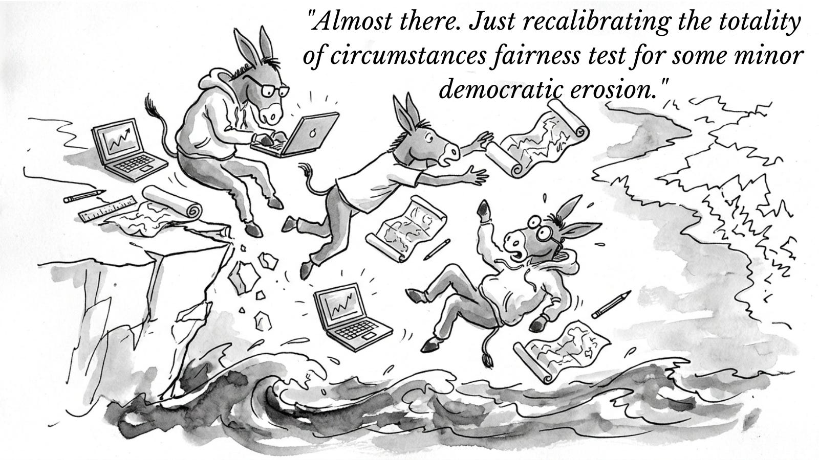
Ban gerrymandering. It sounds so obvious. So simple. Of course we should do it.
Except, there’s just one problem. What is a gerrymander, anyway?
You may think you know it when you see it. But are you so sure? How would you measure it?
Well, let’s start with what we think districts should look like. We want partisan fairness (maps should not favor either party). We want competitive districts (we tend to think competition is good). We want compact districts (distended polygons feel like cheating). We want to keep natural communities together (people who live together should vote together!). We want minority communities to be able to elect their candidates of choice (or at least, some of us do; I do).
The problem is that voters do not equally distribute themselves in perfectly balanced and aesthetically pleasing units of roughly 765,000 people (the going size of a congressional district these days). So choosing where to put the lines means making lots of trade-offs.
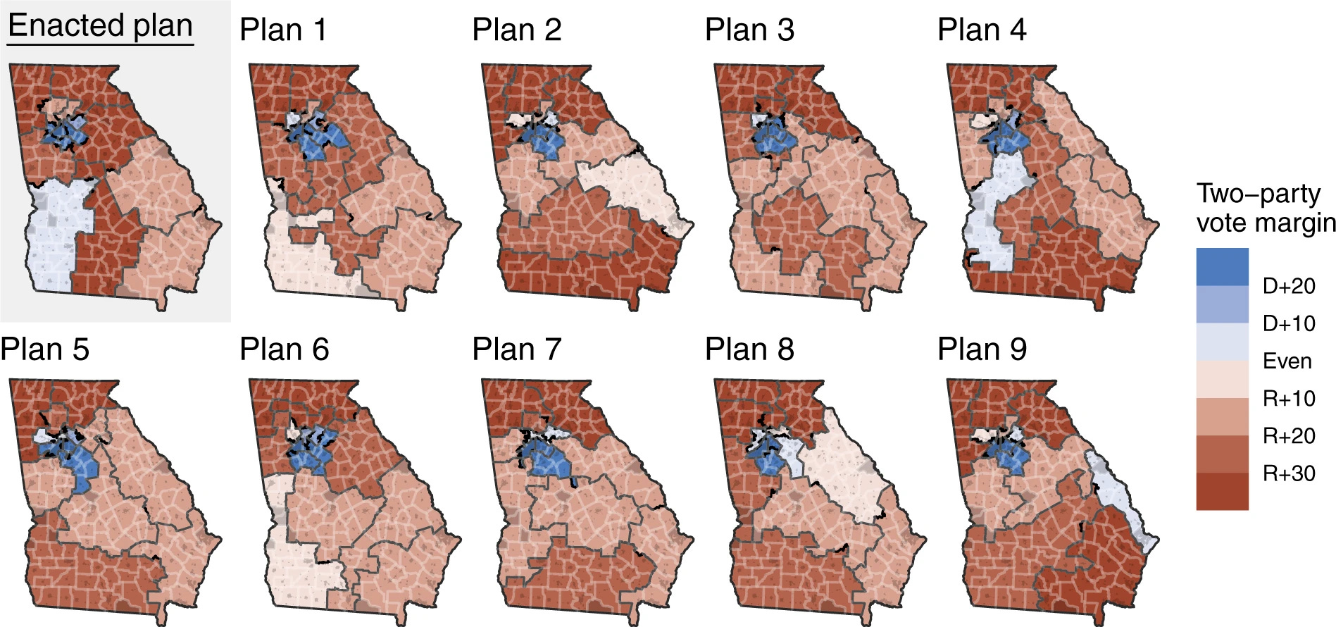
But not only does districting involve trade-offs across all these values. Each of the trade-offs themselves involve trade-offs in how you measure them. Naturally, there is no perfect, universally-agreed-upon way to measure any of these values.
For example, say you care about partisan fairness. Which everybody does these days, because the gerrymandering wars of the 2020s are all about partisan unfairness. How would you measure partisan fairness? There are at least 18 different ways to do this, each with their own advantages and disadvantages.
The “Efficiency Gap“ will give you a slightly different result from the Mean-Median Difference, which will give you a different result from the Declination, which will give you a separate result from the GEO score, all depending on the particular geography and partisan distribution of the particular state. All are gameable.
You could use an ensemble measure, trying to balance multiple measures. But then how do you weight each metric, and which metrics belong in the ensemble? The choices quickly become infinite. But somebody has to decide. And no pressure… partisan control of Congress depends on that decision.
Fairness is fractal
And now for something completely different. How long is the coastline of Britain?
Well, it depends. According to the CIA World Factbook, it is 12,429 km. According to the British Cartographic Society, it is 31,368 km. According to the mathematician Benoit Mandelbrot, it is infinite.
Why? The smaller the measurement unit, the longer the coastline. Meters skip across jagged inlets. Centimeters catch more of them. Millimeters catch even more. It’s fractal expansion, all the way down. Those in the know call it the Coastline Paradox.
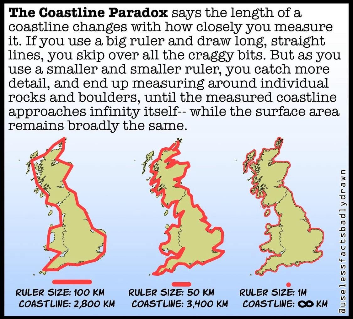
Not much is at stake if the British coastline officially measures 12,429 km or 31,368 km. But imagine if partisan power depended on which number you picked. There’d be a proper row.
Now imagine a state. We’ll call it, oh, I don’t know, Hypothetica.
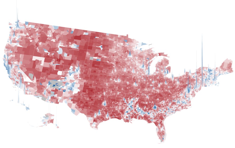
Imagine it as a Midwestern swing state, 50-50 partisan balance, with Democrats mostly concentrated in two blue-dot cities in the south of the state, and Republicans spread out in the rest of the state. This is the typical pattern. Democrats cluster in cities, Republicans elsewhere. Hence, the country looks like a wash of red punctuated by blue spikes when projected onto a map.
Let’s give Hypothetica eight congressional seats. Now, partisan fairness demands four Republican seats and four Democratic seats, right? A 50-50 state should get a 50-50 partisan split, right?
And, yes. You can draw a map that guarantees four seats for each party. Just draw all districts to be 60-40 districts, or 65-35 districts, if you want to be sure. Today’s districting software is precise like that, because voters these days are extremely predictable partisans — they either vote D or R, and rarely switch between the two. And if you draw eight safe districts, you’ve got... eight safe districts. Perfect partisan balance.
But wait… perfect partisan balance, but no competitive districts. That feels like a problem. If there are no competitive districts, then does anybody’s vote really matter? And how do you get new ideas and innovations into politics if there is no competition? We wanted partisan proportionality, sure… but did we really appreciate how much it had to come at the cost of actual meaningful competitive elections?
OK, so you want some competitive districts then? How many? One, two? And can you make them perfectly competitive? Like perfectly, equally competitive? Or might they have a slight tilt in favor of one party or the other? And how would anybody prove that? Well, it depends on the metric of course, which takes us to that whole other problem about no perfect metric we discussed a few paragraphs back.
And what about that thing where Democrats live in those concentrated urban blue dots, and Republicans spread out more evenly? How are we going to draw competitive districts when partisans live in such different places? Sure, you can probably draw a few more competitive districts, but pretty quickly you run into some big trade-offs with partisan fairness. And which do we want to prioritize?
But wait… it gets more complicated. To get that partisan balance or generate some competition, you’re going to need to get creative, pulling some pieces of the cities and pairing them with some further out exurbs. After all, if you just drew districts to keep communities together, keep in mind that most cities these days are like 80 or 90 percent Democratic-voting. You might want to keep those cities together, but then Democrats are going to “waste” a lot of their votes in lopsided districts.
“Wasted” is a remarkable word to use about somebody’s vote. You showed up, your candidate won by a lot. Congratulations. But in the gerrymandering calculus, every vote beyond 50% plus one is wasted. Your party needed your zip code in a different district. So sorry.
So partisan balance or competition demand more equal distribution, which probably means cutting apart cities and drawing districts further out into the hinterlands, which also means making it harder to draw majority-minority districts, since minority voters tend to concentrate in the cities. Fairness for one group requires fragmenting another.
And of course, all of this depends on where people actually live, which varies from state to state, and also like the coastline, changes over time depending on the ebbs and flows of the tide. People do move.
And so... in short... districting is a land of contrasts.
If you’re confused at this point, good. It is extremely confusing. (Again, I recommend my white paper on the challenges of districting, which provides a more methodical version of this argument.)
But bottom line: There are a lot of complicated trade-offs, and no simple formula for drawing a fair map. There are complicated mathematical formulas you can plug into a computer algorithm, and it will obligingly disgorge dozens of possible maps with dozens of possible scores. Somebody has to decide which trade-offs matter most. Or, perhaps, based on what they think they can get away with, depending on their goals.
Everyone agrees gerrymandering is bad. Nobody agrees on what it is.
As I’ve noted in my previous essay here on the history of gerrymandering in America, there has never been a golden age of fair districts in America. The districting problem has been with us since the start, in various jagged forms and shapes. But the current gerrymaxxing wars (as the internet has taken to calling them) are uniquely ugly. The fenniest maps in a history that was never pretty.
Right now, with the Supreme Court giving the green light to partisan and racial gerrymandering, and the norms against mid-decade redistricting now shredded, the Grand Prix flag is raised and both parties are off, trying to achieve maximum partisan advantage before the next election. Which, again, thanks to fancy computer algorithms and predictable partisan voting, is a thing that maps can achieve these days with sociopathic precision. Republicans are ahead in 2026. But Democrats have plenty of opportunities before 2028.
Hence, the prominent calls to “ban gerrymandering.”
The latest and greatest(?) attempt to do this legislatively is the 2025 Redistricting Reform Act, which Democrats have written, and which has 52 cosponsors.
Here’s what the bill does.
First, it requires every state to create an independent redistricting commission — fifteen members, five from each major party and five independents, with the independents choosing the chair. No plan can pass without at least one vote from each group, which means the five independents hold the balance of power.
Second, it sets a ranked hierarchy of criteria the commission must follow: comply with the Constitution (duh), comply with the Voting Rights Act, protect minority voters’ ability to elect candidates of choice, and preserve communities of interest. Notice what’s not on that list: compactness and competition. They were in earlier versions of the bill. They got dropped.
There’s a problem with items two and three on that list.
In April 2026, the Supreme Court gutted both. Its 6-3 decision in Louisiana v. Callais eviscerated Section 2 of the Voting Rights Act — the provision that for six decades required mapmakers to avoid diluting minority voting power. Republican-controlled states are already rushing to dismantle majority-minority districts in response. The bill’s second-ranked criterion now references a law the Supreme Court has largely defanged. Its third-ranked criterion describes a right that may no longer be enforceable. Two of the bill’s five load-bearing walls were knocked out before the foundation was even poured.
Third, and this is the big one: the bill says that no state may use a map that “has the intent or effect of materially favoring or disfavoring any political party.”
So, the bill is trying to engineer partisan proportionality, but within the confines of single-member districts. Which, again, means all kinds of other trade-offs. And the likely result will be almost no competitive districts.
But, wait… read that again. No map that “has the intent or effect of materially favoring or disfavoring any political party.”
Wait: how do you know when a map “materially” favors a party? The bill says: use “standard quantitative measures of partisan fairness that relate a party’s share of the statewide vote to that party’s share of seats.” It does not say which ones.
It does set a threshold, however. If a map’s partisan skew exceeds 7 percent or one congressional seat, whichever is greater, across at least two of the last four statewide elections, it’s presumptively illegal. And the moment someone files a challenge, the map is automatically stayed. The state can’t use it until the courts sort it out, even if there’s an election around the corner.
The ultimate determination is a “totality of circumstances” test, where a court weighs everything holistically.
If you’re thinking, “wait, that sounds like it leaves a lot up to the judges,” you’re right. It does.
You can measure a map six ways and get six verdicts. Somebody still has to rule.
So let’s go back to Hypothetica. It’s 2031, and the state has shifted. It’s no longer 50-50. It’s now 56-44 Democratic — still competitive, but Democrats have a clear statewide edge. The state has dutifully set up its shiny new independent redistricting commission, just like the bill requires. The commissioners are serious people. They hire experts. They hold public hearings. They livestream everything. They do all the things.
They draw a map with five Democratic-leaning seats and three Republican-leaning seats. A 5-3 map for a 56-44 state. Not proportional. That would be closer to 4.5 to 3.5, which, last I checked, you can’t do with human representatives. But reasonable. Close enough. Fair enough. Right?
Republicans sue. Of course they do. Their lawyers argue: 56 percent of the vote should not translate to 62.5 percent of the seats. That’s a six-and-a-half-point gap between vote share and seat share.
Your Honor, we ran the efficiency gap, and this map exceeds the statutory threshold in three of the last four elections. Presumptively illegal.
The commission’s lawyers fire back: we ran the mean-median difference, and the map is clean. Well within normal range. No partisan skew at all.
The court appoints its own expert. The expert runs the declination (which measures the angle of the vote distribution, and yes, that is a real thing) and gets an ambiguous result.
So the Republicans’ team runs the partisan bias score. Slight Democratic lean, they say.
The commission’s team runs the GEO metric. Fair, they say.
The Republicans bring in a second expert who runs a lopsided margins test. Inconclusive, she says, but suspicious. At which point a third expert submits testimony based on the reverse cosine Mandelbrot spectral decomposition test with a Bernoulli adjustment, which shows that time actually runs backwards (OK, I made that one up. But what judge knows enough statistics to tell?)
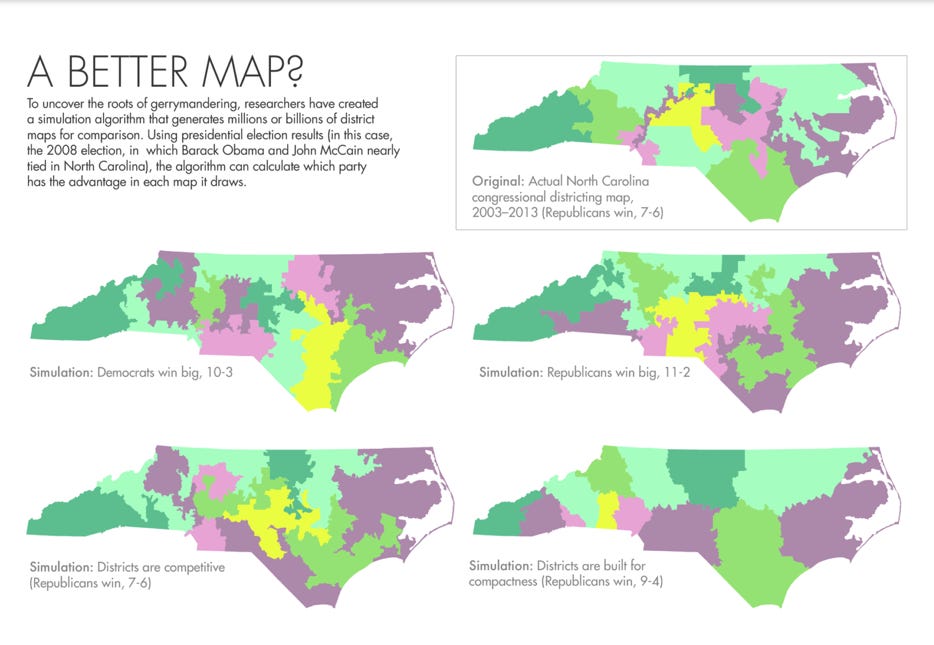
Finally, a political scientist at a think tank runs an ensemble analysis (ten thousand computer-generated maps simulated by algorithm) and the result is that it depends on which algorithm you use, how you weight the different metrics within the algorithm, which settings you pick, and how you define the seed population of maps, and hence, there is no way to draw single-member districts fairly and it would just be wiser to use proportional representation and be done with this whole madness of single-member districts.
Except for the reverse cosine Mandelbrot spectral decomposition test with a Bernoulli adjustment, these are all real measures, published in real journals, by scholars who have spent real careers developing them.
The academics continue to argue with each other about which one is right, either because they genuinely enjoy arguing (and I can confirm, many do), or perhaps because there is a vibrant and growing market for alternative metrics and expert witnesses who submit them. Either way, the problem appears unsolvable. Like the coastline, the closer you look, the more complicated it gets. The measurement is infinite.
Now imagine you’re a judge. You went to law school. You did not go to law school to learn computational geometry. You have before you a dozen credentialed experts who cannot agree on whether this map is fair, and two orchestras of lawyers who are each billing at rates that could fund a rural hospital, and the entire partisan balance of the United States House of Representatives may hinge on your ruling. What do you do?
You do what the bill tells you to do. You apply the “totality of circumstances” test. You weigh everything. You use your judgment. In short: you guess.
But let’s say you rule against the map. You say: 5-3 is too many Democratic seats. Draw a new one. So the commission goes back and draws a 4-4 map. Now the Democrats sue. Their lawyers argue: Your Honor, 56 percent of the statewide vote and only 50 percent of the seats? That’s also materially disfavoring a political party. That’s our party. You’ve taken the cure and made it the disease. The remedy is more illegal than the violation.
At this point, imagine you’re the expert witness, on the stand, under oath. The lawyer leans in. “Dr. Expert. You’ve testified that this map is unfair. You’ve presented your metrics. You’ve shown your calculations. So let me ask you a simple question.” Dramatic pause. “How long is the coastline of Britain?”
And Dr. Expert, who has a PhD and seventeen peer-reviewed publications and a well-funded lab, looks up and says: “Well... it depends on how you measure it.”
“No further questions, Your Honor.”
When the stakes are existential and the rules are ambiguous, every independent commission is a lawsuit waiting to happen.
We’re not done. The case goes up on appeal. Eventually it reaches the Supreme Court — the same Court that ruled in Rucho v. Common Cause in 2019 that partisan gerrymandering was a “political question” beyond the reach of the federal judiciary. Congress has now passed a statute that tries to provide the standard Rucho said was missing. Good luck with that.
Even if the courts settle on a metric, every metric is gameable. Once every mapmaker in America knows exactly what number to hit, they will hit it and not a tenth of a point more. The measure becomes the target, the target becomes the game, and the game produces maps that pass the test and rig the result.
The bill requires every state to create an independent redistricting commission. But how do you prove the commissioners are independent? In Arizona, the “independent” chair of the redistricting commission — a registered Independent — voted with the two Democratic commissioners on virtually every decision. The Republican governor tried to remove her. The state Supreme Court put her back. The resulting map was a pro-Democratic outlier according to ensemble analysis. In New York, the commission was evenly divided and deadlocked — Republican commissioners had every incentive to fail, because failure eventually threw the map to the courts, which was a better deal than compromise. The Democratic legislature stepped in and drew its own gerrymander. Courts struck it down. The commission process has now failed twice.
Independence is another coastline. You can define it at the level of party registration, or prior donations, or social networks, or actual voting behavior on the commission, and each finer measurement surfaces new fractal edges. Registration is a checkbox, not a soul.
A decade ago, this might have been adequate. But that era is over. We need to start thinking outside the single-member district.
The solution is hiding outside the district
There is a brain-teaser puzzle you may have heard of called the “nine dots puzzle.” Three rows of three dots each, and the object of the puzzle is to connect all the dots with four straight lines, without lifting up your pencil.
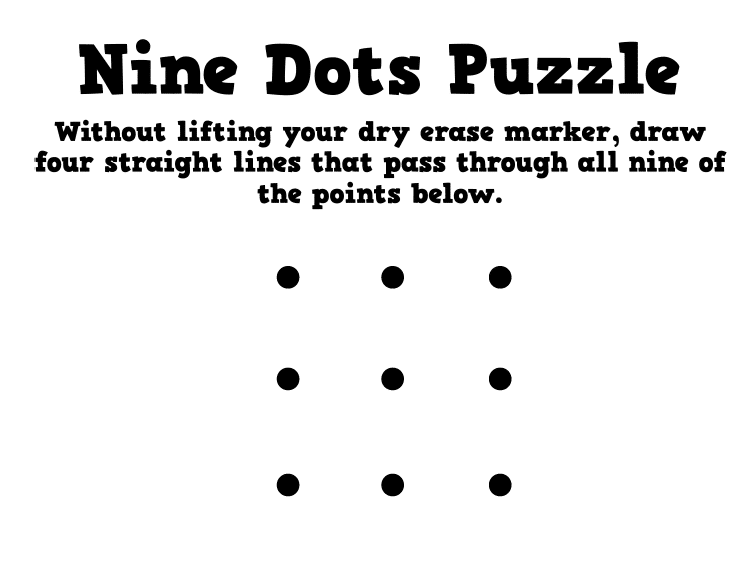
The trick is going “outside the box” — using diagonal lines that extend beyond the grid. Once you see it, it seems obvious. But until you see it, you are convinced there must be a solution within the box.
Trying to do “fair” districting within the single-member district is very much like trying to connect the nine dots without going outside the box. It feels seductively possible. It is not.
Proportional representation is the diagonal line outside of the box. Errr, district.
When I read about lawsuit after lawsuit arguing over “fair maps” and read academic paper after academic paper arguing over how to measure gerrymandering, I feel like I am watching very smart people argue over how to solve the nine-dot puzzle within the confines of the traditional box.
Enact proportional representation, get rid of districts, or at least make them multi-member and proportional, and the trade-offs dissolve. Under multi-member districts with proportional allocation, a party’s seat share tracks its vote share mechanically. There is nothing to measure and nothing to litigate. You can have competition and partisan fairness and minority voters can elect their candidates of choice. There is no gerrymandering, because in many states, there are no lines to draw. And even in larger states, where you might want to draw a few lines, the results in each multi-member district are proportional. Cracking and packing just cracks and packs itself into obscurity.
So, what’s the holdup? Yes, single-member districts are the status quo. But what is sacred about the principle of maintaining single-member districts when they are causing so many problems? They are not in the Constitution. They were not even the norm until 1842. And with all the constant redrawing and splitting of communities, they don’t even correspond to any semblance of a constituency. What is the principle we are trying to preserve here, anyway?
If Democrats win a trifecta in 2029, they will face a choice. They can pass the Redistricting Reform Act. They can mandate commissions, set partisan fairness standards, and build the enforcement architecture I’ve described here. Or they can end the gerrymandering wars altogether and pass proportional representation.
Forty percent of the vote, 40% of the seats. No metrics to game. No expert witnesses debating the length of the coastline. I’ve made the full case elsewhere, most recently on The Ezra Klein show.
The Redistricting Reform Act keeps trying to connect the dots without going outside the box. It invites a generation of litigation, makes 95% of seats safe, and preserves the two-party system that guarantees the doom loop continues to get doom-ier and loop-ier.
Proportional representation is the diagonal line outside the box. It is the only fair peace treaty that ends the gerrymandering wars and breaks the two-party doom loop that is currently the greatest threat to American democracy.
In the meantime, when you hear a politician promise to “ban gerrymandering,” ask them how. Ask which metric. Ask what happens when the metrics disagree. Ask what happens when the mapmakers game it. Ask whether they accept that partisan fairness means safe seats and safe seats mean most Americans never cast a meaningful vote for Congress. Maybe they have a brilliant answer. Maybe there’s a magic formula I’ve missed.
But chances are, they have no idea how long the coastline is. Or how quickly it is crumbling into the sea.

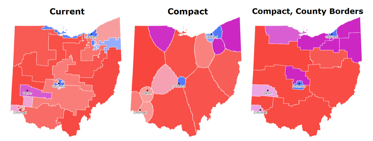
Gerrymandering can be ended by giving up on all these extraneous goals! If districts only have to have one property—compactness—then no trade-offs are required. I argue for this path in “Resist, Adapt, Redistrict” (https://expanddem.substack.com/p/resist-adapt-redistrict).
Get rid of all those vague and hard to measure goals, like “partisan fairness” and “competitive districts.” And as the author of “Breaking the Two-Party Doom Loop” knows, we should definitely not be designing our electoral system to serve the two parties, as if no one else mattered. Micro-managing democracy is intrinsically anti-democratic. Let’s stop doing it. Then we can end gerrymandering.
Can Congress mandate that states use proportional representation, or can it only allow them to do so, if they wish?
If the latter, then my fear would be that only blue states would try PR, which would make the House even more unrepresentative.